The Parish Council has responded to the consultation on the new local plan being prepared for that part of Lewes District outside the National Park as follows:
Peacehaven’s location between the Channel cliffs and the South Downs National Park is a special characteristic that must be recognised and preserved. The South Downs Local Plan (Policy SD6) seeks to preserve and enhance the visual integrity, identity and scenic quality of the National Park. Suburban development across open downland right up to the park boundary contradicts this. Reasonable intensification within Peacehaven (as per Spatial Option 1) can continue to meet housing need, but the further encroachment of open and protected downland should be clearly ruled out.
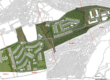
The South Downs Local Plan (Policy SD6) is concerned to preserve and enhance the visual integrity, identity and scenic quality of the National Park. As well as offering key views of its South Downs setting from urban Peacehaven, the land in question forms part of dramatic views of the coast, south out of the park from the rising land and cluster of grade 2 listed buildings at Hoddern Farm and from Lodge Hill beyond within Piddinghoe Parish.The high density Chalker’s Rise development (450 dwellings almost completed) was conceived as providing a softer urban edge to Peacehaven, leaving a narrow green farmland buffer up to the Piddinghoe Parish boundary. Extending Chalkers Rise eastwards would diminish that buffer and suburbanise the National Park’s setting. In order to protect the urban fringe from uncertainty and neglect, the new Local Plan must designate the current eastern edge of Chalker’s Rise as the definitive settlement boundary to Peacehaven.